On February 25, the NEOSCC Board will be voting on the the Vibrant NEO 2040 Vision, Framework and Action Products. With just under 40 days to the vote and 41 initiatives in the vision, we thought it would be good to create a countdown to the vote. Everyday over the next 5 weeks, we will be sharing an “Initiative A Day” with you so you can gent a better understanding of the vision and framework! If you would like to read all of the Initiatives, you can download them here Vibrant NEO_Recs&Init_010114.
Show your support for Vibrant NEO 2040 by adding your name to our Champions of Vibrant NEO 2040 list here!
These recommendations, initiatives, and products, are not one-size-fits all and some aspects of the initiatives won’t be applicable everywhere in the 12-county region. The Vibrant NEO 2040 Vision, Framework and Products are intended inspire and guide decision-making at the Metropolitan Planning Organization (MPO), Council of Government, and local levels to ensure that land use, transportation, and environmental considerations are simultaneously addressed by their processes. Ultimately, the implementation of Vibrant NEO 2040 is up to Northeast Ohio’s communities and residents. But regardless of the applicability of each initiative to any particular part of the region, the goal for each community within the Vision is the same: stability, prosperity, and a high quality of life for all of its residents.
Recommendation 2: Develop a robust network of regional job centers connected by multimodal transportation corridors within and between counties
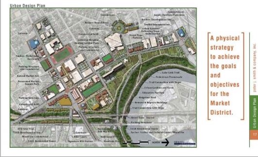
Initiative 2.2: Use transit oriented development (TOD) to create stronger, more accessible, regional job centers.
WHAT THIS MEANS. Coordinating land use and transportation sets the stage for residents and employers to be well-served by public investment in high capacity transit. This initiative involves focusing local land use policies throughout the Northeast Ohio region to respond to regional high-capacity transit service. This not only looks to shape urban form in a way that promotes walking and transit access, but also to encourage and foster population and employment densities that are necessary for transit service to be feasible.
Urban regions beginning to invest in transit understand that the major commitment of public and private funds to build and operate transit systems requires securing a successful public service that offers community benefit and a foundation for economic growth. Charlotte, North Carolina is a leading example of a region that has oriented its growth policies to infrastructure corridors served by high-capacity transit, with a series of ‘wedges’ consisting of lower-density housing and parks and preservation lands making up the spaces in between and continuing to offer housing choices to the region. Working hand-in-hand with this growth framework is a series of station area plans that reshaped local land use policy and development regulations to promote the critical densities of population and employment needed to support this high-capacity transit service.
WHY THIS IS IMPORTANT. Land use policy is not always immediately understood in planning for transit, but coordinating it in transportation planning efforts is crucial in ensuring transit’s effectiveness. Transit needs to have adequate ridership for service to be successful, but it also needs for land uses to be balanced and configured in a way that takes full advantage of the service’s capacity and allows riders to reach transit vehicles. This initiative is focused on land use because it is essential to ensuring that public investment in transit infrastructure and service yields benefits to Northeast Ohio.
When coordinated well, this kind of land use and development planning offers community benefit in creating desirable places that offer choices in transportation, but it also benefits transit service providers in adding ridership, building a long-term demand for transit service, and extending the utility of transit service by allowing reverse-peak use of transit service and potentially offering more ‘even’ ridership activity throughout the day.
GETTING IT DONE. Recommendation 5 calls for regional action and coordination on transit development, but local government policy will ultimately lead the implementation of this initiative. This is often expressed in broader terms in long-range and comprehensive development plans, but it needs to be codified in zoning ordinances so that restrictions to individual development choice is removed and property owners may build transit oriented development as of right. To support transit, especially around high-capacity stations, there needs to be a minimum level of population or employment density and a favorable mix of land uses that can be easily accommodated without requiring a car. Generally speaking, this focuses on residential, employment, and, to a lesser degree, retail and commercial land uses. The specific type of use matters, though, in that transit is more effective in serving land uses that lead to a high concentration of households and jobs. Land uses that offer employment at lower intensities, such as warehousing and distribution, and similar services are not as likely to support transit and should not be the focus of transit-supportive area plans.
TOOL: Connecting Jobs and Workforce Development to Transit. http://origin.library.constantcontact.com/download/get/file/1101453267843-205/20130924_Jobs_Transit_Issue_Brief.pdf

