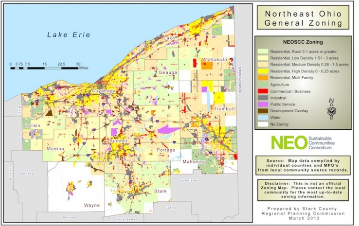
Tool Name: Northeast Ohio General Zoning Map & Data
Description: NEOSCC has created a parcel-based zoning map for the 12-county Northeast Ohio region from information supplied by each of the 393 jurisdictions in the region. This map can be scaled to the size of individual communities and counties and can be filtered to show in clear detail the location of specific zoning classifications, such as residential, industrial, commercial, and agriculture. The GIS data behind the maps is included by county and each file contains the local zoning, local land use, NEOSCC zoning and NEOSCC land use codes.
Website: https://vibrantneo.org/vibrantneo-2040/file-upload/
Introduced: 2013
Award/ Recognition: N/A
Contact Organization:
Northeast Ohio Sustainable Communities Consortium
146 S. High Street, Suite 800
Akron, OH 44308
330-375-2949
Additional Resources:
NEOSCC land use and zoning codes
NEOSCC zoning map – detailed code categories
Topic: Planning Resources; Jurisdiction: NEOSCC Region, MPO/COG Metro Area, County, City, Village, Township; Community: Legacy Industrial City, 1st Ring Suburb, 2nd Ring Suburb, Outer Ring Suburb, Established City or Town, Rural Township; Category: Tool.

