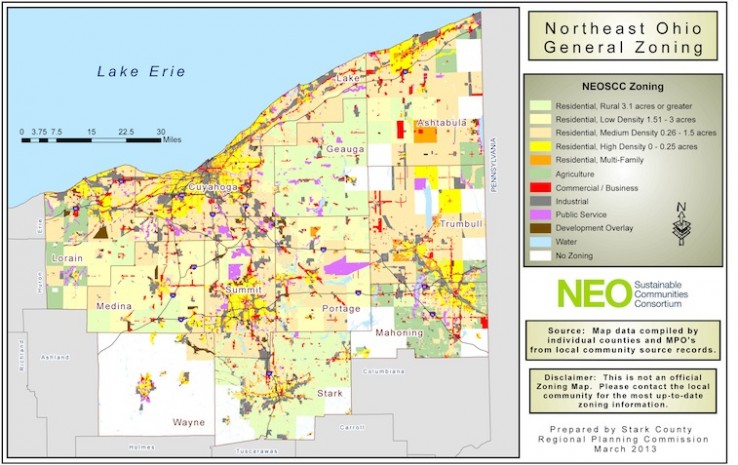
NEOSCC has created a parcel-based zoning map for the 12-county Northeast Ohio region from the most current information supplied by each of the 393 jurisdictions in the region. This map can be scaled to the size of individual communities and counties and can be filtered to show in clear detail the location of specific zoning classifications, such as residential, industrial, commercial, and agriculture. The GIS data behind the maps is included by county and each file contains the local zoning, local land use, NEOSCC zoning and NEOSCC land use codes.
Download Map
Land Use and Zoning Map Data
If you are interested in the background data for these two maps, you can access it through the downloads below:
Land Use and Zoning Zip File 1
Land Use and Zoning Zip File 2

