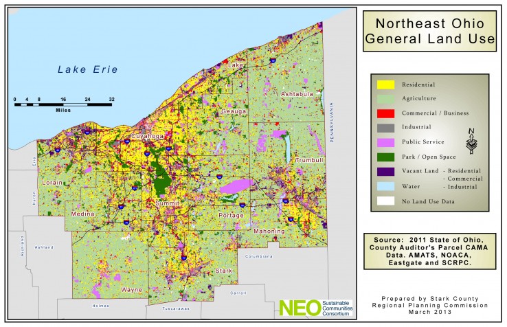
As part of the Vibrant NEO 2040 initiative, NEOSCC has completed the first-ever existing land use map for the 12-county region. This parcel-based map was built on detailed real estate information provided by the region’s 12 County Auditors and County Fiscal Officers. This map can be scaled to the size of individual communities and counties and can be filtered to show in clear detail the location specific land uses, such as industrial, commercial and park land. Because it is based on current real estate data, this map provides a real-time picture of vacant urbanized land throughout the region.
Zoning Map
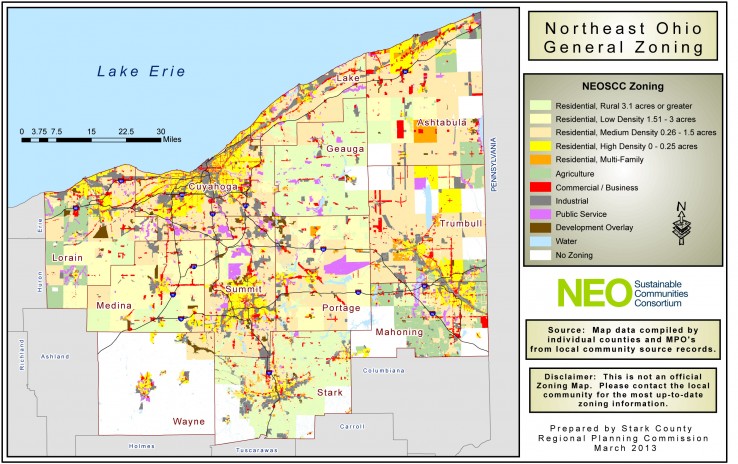
NEOSCC has also created a parcel-based zoning map for the 12-county Northeast Ohio region from the most current information supplied by each of the 393 jurisdictions in the region. This map can be scaled to the size of individual communities and counties and can be filtered to show in clear detail the location of specific zoning classifications, such as residential, industrial, commercial, and agriculture. The GIS data behind the maps is included by county and each file contains the local zoning, local land use, NEOSCC zoning and NEOSCC land use codes.
To download pdf’s of these two maps visit our Tools and Resources page.


