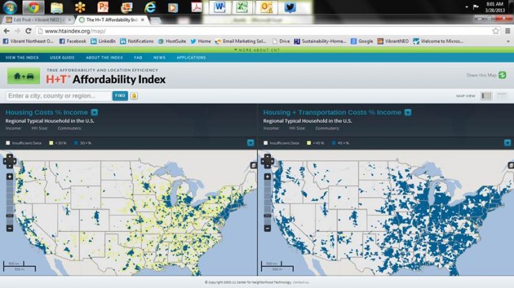
As two of the most significant expenses in our personal lives, housing and transportation cost can play a key role in our quality of life and where we choose to live. Over the last few years a new tool has been developed by the Center for Neighborhood Technology to analyze some of these costs relative to income and geography.
To integrate this way of thinking into the choices and decisions made by home buyers, renters, urban and transportation planners, and developers, CNT and our collaborative partner, the Center for Transit Oriented Development (CTOD), developed a groundbreaking tool, the Housing + Transportation Affordability Index, that measures the true affordability of housing choice-by factoring in both housing and transportation costs in a neighborhood.
The cost of getting around takes a significant bite out of household budgets. The average family in the United States spends about 18% of after-tax income on transportation, but this varies significantly by income and geography. The H+T Index establishes an affordability standard for transportation costs of 15% of household income.
The H+T Index offers an expanded view of affordability that combines housing and transportation costs and sets the benchmark for housing and transportation affordability at no more than 45% of household income. By this measure, the number of affordable neighborhoods in the United States drops to 28%.
A regional view of H + T Costs can be found on the Conditions and Trends platform. You can use the index on-line to compare different geographies in Northeast Ohio as well as other parts of the country.

